
Map of acoustic moorings in the ACOBAR project.
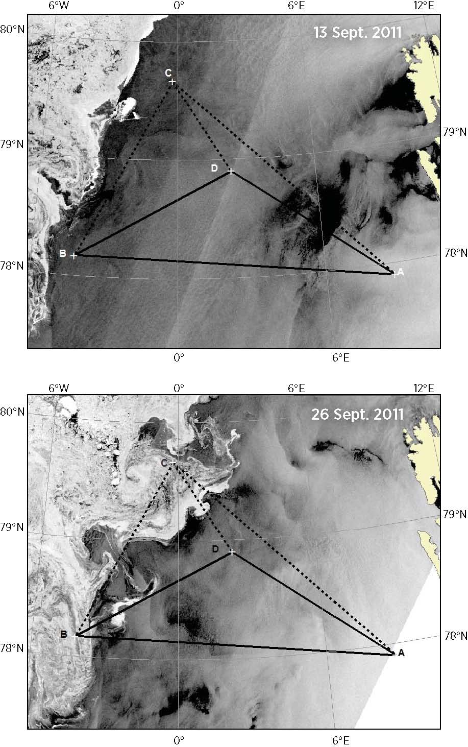
FIG. 2 (sagen et al. 2017). Sea ice in Fram Strait as shown on ENVISAT ASAR (Advanced Synthetic Aperture Radar) images acquired on 13 (top) and 26 (bottom) September 2011. The white areas to the west are ice, and the dark areas are open water. Acoustic data for paths A-D, B-A, and B-D (solid) are provided in the Catalogue. The paths involving mooring C (dotted), because the mooring failed shortly after deployment, and therefore data not available. Svalbard is evident to the east.
Additional Information
| Field | Value |
|---|---|
| Data last updated | November 19, 2018 |
| Metadata last updated | November 16, 2018 |
| Created | November 16, 2018 |
| Format | JPEG |
| License | Creative Commons Attribution |
| Has views | True |
| Id | a5fccde7-2f08-482d-a0aa-09842e953bcc |
| Mimetype | image/jpeg |
| On same domain | True |
| Package id | e74e202d-4ded-4e76-aa62-bfcab2ae8260 |
| Size | 142.9 KiB |
| State | active |
| Url type | upload |